This page last revised 01 September 2006 -- S.M.Gon III
Introduction
Ecoregion
Conservation Targets
Viability
Goals
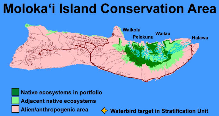
Portfolio
TNC Action Sites
Threats
Strategies
Acknowledgements
▫
Tables
Maps & Figures
CPT Database
Appendices
Glossary
Sources
Montane wet forest on the edge of Pelekunu Valley, Kamakou Preserve.

The Moloka‘i community is extremely involved in the management of the island's Conservation Area.
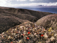
The leeward slopes of East Moloka‘i descend into lowland mesic shrublands.
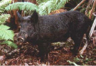
Non-native pigs, escaped into the wild, pose a threat to native ecosystems, but are also a local food source.
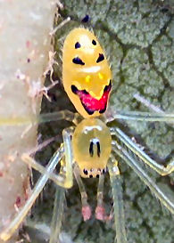
Anuntold number of native invertebrates, such as this Hawaiian happyfacespider, are nested within East Moloka‘i native ecosystems.
Conservation Area Profile
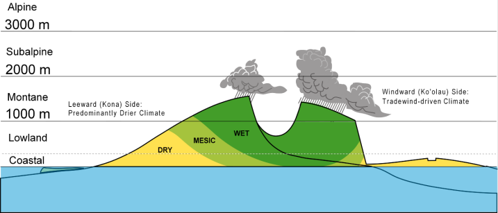
Major Habitat Type: Tropical Moist
Stratification Unit:Maui Nui (comprised of the islands of Maui, Moloka‘i,Kaho‘olawe, and Lāna‘i; of similargeological age and sharing biodiversity via geological history thatcombined all as a single large island during a lower stand of the sea).
Island:Moloka‘i; the fifth largestisland of the archipelago, ca 1.8 million years old, maximum elevation1514 m(4,970 ft), comprised of a single native dominated landscapecorresponding to the largest volcanic mass on the island, the EastMoloka‘i Volcano. Approximately 7,000 human residents.
Significance: The East Moloka‘i Conservation Area is comprised of ecological systems from lowland to montaneelevations. The summit area and undeveloped north side maintain high viability systems, are animportant watershed, and contain over 50 native natural communities (four of which are unique to Moloka‘i). East Moloka‘i supports 248 Hawaiian endemic species offlowering plants, 25 of which are endemic to the island, and 39 ofwhich are endangered.
ConservationStatus: The East Moloka‘i Conservation Area is protected and managed by acombination of private and public protected areas, including Kalaupapa National Historical Park, Pu‘u Ali‘i StateNatural Area Reserve, Oloku‘i State Natural Area Reserve (one of the last native forest areas naturally ungulate free), the State Forest ReserveSystem, and the State Conservation District. The East Moloka‘i Watershed Partnership,comprised of a combination of the above lands with selected lands ownedand/ormanaged by Kamehameha Schools; Kapualei Ranch and Kawela Plantation Homeowners Association; Ke Aupuni Lōkahi Enterprise Community Governance Board;Hawai‘iDepartment of Health; State Division of Forestry and Wildlife;Kalaupapa National Historical Park; Maui County; Maui Board of WaterSupply; Moloka‘i-Lana‘i Soil and Water ConservationDistrict; USDA Natural Resources Conservation Service; US Fish & WildlifeService; US Geological Survey; US Environmental Protection Agency; andThe Nature Conservancy. A management plan has been drafted that implementsfencing, ungulate control, and weed control, ignoring land jurisdictionboundariesand dealing with the major threats. Such actions are included in a discussion of Moloka‘i conservation strategies.
For more detailed information, contact the Moloka‘i Office of The Nature Conservancy of Hawai‘i
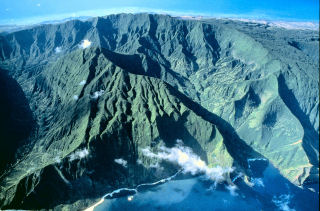
Oloku‘i Plateau, between Wailau and Pelekunu Valleys, Moloka‘i
Cover image for the East Moloka‘i Conservation Area Plan
Major Threats:Uncontrolledferal ungulates (primarily pigs, goats, deer); a variety ofestablished and potential habitat-modifying alien plants, and wildfire at lower dry and mesic settings.
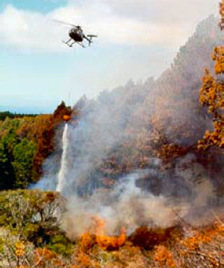
Wildfire is a serious threat in the East Moloka‘i Conservation Area
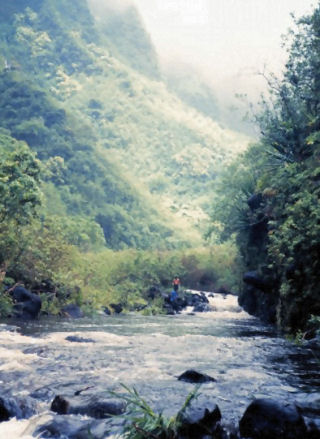 Hawaiian Continuous Perennial Stream, Pelekunu Valley, Moloka‘i
Conservation Targets:
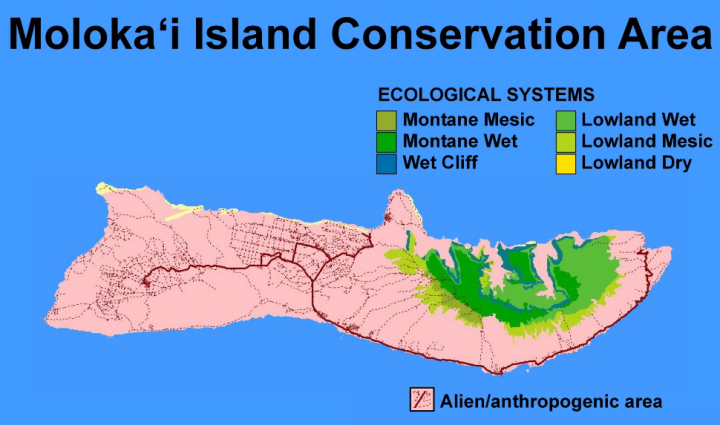
Ecological Systems: Three ecological systems of Moloka‘i were selected as conservationtargets, each bearing nested natural communities and species (discussedbelow).
| System | Size | Condition | LC | Overall |
| Montane Wet | FAIR | GOOD | VERY GOOD | GOOD |
| Montane Mesic | FAIR | GOOD | FAIR | FAIR |
| Wet Cliff | POOR | GOOD | GOOD | FAIR |
Otherecological systems were either ranked poor in viability (and thus notincluded) or were ranked fair, but were not selected in lieu of otherhigher-ranked Maui Nui representatives of those systems.
Natural Communities:
- Continuous Perennial Stream Community
Special Ecological Features:
- Waterbird Concentration
- Natural Communities:
‘Ōhi‘a/Mixed
‘Ōhi‘a/Mixed Shrub Montane
‘Ōhi‘a/‘Ōlapa Montane
‘Ōhi‘a Mixed Lowland Mesic
Pleomele Lowland Mesic
Hawaiian Montane Bog
Mixed Fern/Shrub Wet Cliff Community
Mixed Shrub Dry Cliff Community
Montane Piping Cave Community
- Native species:
There are manyconstituent native species that comprise the natural communities of the ConservationArea. Highlights include more than 16 rare/endangered plant species, over 150 endemicflowering plant species, and an untold number of endemic invertebrate species likelynumbering in the thousands.